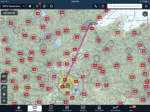
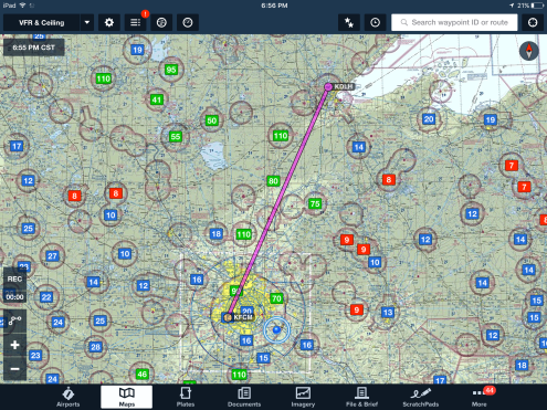
Visual and Instrument flying alike both have minimum requirements for flights based upon many factors. Getting accurate and useful weather updates prior to departing and while in the air is important so that a safe and efficient flight can be executed. Finding the useful information isn’t too difficult as there are many resources available such as using an application like Foreflight, or going to http://www.aviationweather.gov. Creating an effective procedure towards getting your information is essential, so I am going to explain my process involved using Foreflight. I just did a simple flight plan from KFCM (Flying Cloud Airport) to KDLH (Duluth International Airport). Generally, I like to use the VFR Sectional Chart to add the different weather criteria in which my route will involve. Using the Foreflight application on my Ipad Mini, the overlays are nicely laid out creating a very simple layout where you can work procedural from top to bottom.
The first thing I start out with is selecting the Radar so that I can visibly see any significant weather to give a basic insight towards what kind of weather to be expected, such as IFR conditions,or VFR. I proceed to check the conditions at my Departure point and also at my Arrival point. 
Simply go through the different reports. (METAR, TAF, MOS, and Winds Aloft)
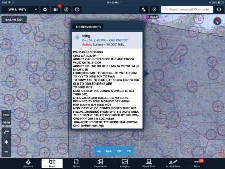
Second, I pull up the Radar summary, then select the AIRMET/SIGMET reports for the given areas. I am generally checking for Ice levels and the flight category the area is depicted as. I find it helpful to reference http://www.aviationweather.gov as well and print out the TAF with the METARS for applicable surrounding airports so that you might know what to expect in the future.
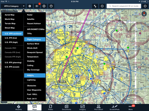
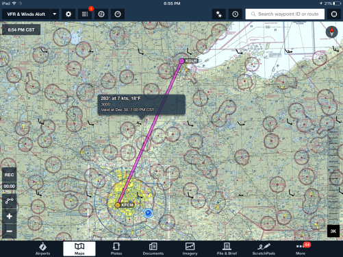
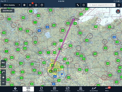
Finally, I go down the list and select the different overlays to explain what the conditions are like at all of the reported areas near my routing. checking for any Temporary Flight Restrictions, the Flight Category (VFR, MVFR, IFR, LIFR), Winds Aloft (Specifically relative to altitude chosen), Temperature and Dewpoint, Reported Visibility, Cloud Ceilings, and Sky Coverage. Another good thing to look for are Pireps (Pilot reports), to see if any reported conditions of changes in WX or any in-flight set backs such as ice or turbulence.
I hope everybody is having a great Holidays, and please let me know in the comments what you use for getting your weather!
I was told a good/realistic protocol towards should an engine-out emergency occur at night. You know for fact that you won’t make any runway and are now in a descent into the black abyss below.
- Pitch for Best Glide
- Attempt to Restart the Engine and Declare the Emergency
- Use best judgement towards which direction into the darkness will be best suitable for a off-field landing
- Turn the Landing Light ON
- If you don’t like what you see with the Landing Light ON……. Heavily Wooded Area
- Landing Light OFF
- If you don’t like what you see with the Landing Light ON……. Heavily Wooded Area
- Turn the Landing Light ON
- Use best judgement towards which direction into the darkness will be best suitable for a off-field landing
- Attempt to Restart the Engine and Declare the Emergency
Visit http://www.globalair.com for more great aviation themed blogs and posts!

Riley. We sure do enjoy reading your blog…keep studying and reaching for that degree, it will be your ticket to great success in the future! So proud of how far you have come in the past year?
LikeLike
Thank you very much for taking the time to read my Blogs!
LikeLike
Very cool, I’m going to start using this more. I’m a fan of aviationweather.gov/Duats
LikeLike
It’s a great website, but the most effective way to get the weather is to use multiple sources whether that be foreflight and aviationweather.gov. It’s your choice!
LikeLike
Thanks guys, I appreciate the comments and feedback. Mcjonesqwe, aviationweather.gov is my go to simply because it is really easy to get the big picture of everything with Radar at one time. You can easily click on TAF’s and underneath the maps you can add multiple airports (ex. KFCM KSTC KMSP) and add the METARS on top of that so you get a nice decoded briefing for your route of flight that is super convenient to print out and take with you! Do you use Foreflight or Garmin at all?
LikeLike